
Leisure World 🇺🇸
-
Nautical Twilight begins:05:11 amSunrise:06:14 am
-
Sunset:07:58 pmNautical Twilight ends:09:01 pm
-
Moonrise:-
-
Moonset:08:10 am
-
Moon over:03:51 am
-
Moon under:04:11 pm
-
Visibility:87%
-
 Waning Gibbous
-
Distance to earth:384,496 kmProximity:49.8 %
Moon Phases for Leisure World
-
average Day
-
major Time:02:51 am - 04:51 am
-
minor Time:07:10 am - 09:10 am
-
major Time:03:11 pm - 05:11 pm
-
minor Time:11:13 pm - 01:13 am
| Date | Major Bite Times | Minor Bite Times | Sun | Moon | Moonphase | Tide Times |
|---|---|---|---|---|---|---|
|
Sat, 27 Apr
|
02:51 am -
04:51 am
03:11 pm -
05:11 pm
|
07:10 am -
09:10 am
11:13 pm -
01:13 am
|
R: 06:14 am S: 07:58 pm |
R: - S: 08:10 am |
Waning Gibbous |
|
|
Sun, 28 Apr
|
03:38 am -
05:38 am
04:07 pm -
06:07 pm
|
08:03 am -
10:03 am
11:13 pm -
01:13 am
|
R: 06:13 am S: 07:59 pm |
R: 12:13 am S: 09:03 am |
Waning Gibbous |
|
|
Mon, 29 Apr
|
04:38 am -
06:38 am
05:02 pm -
07:02 pm
|
12:11 am -
02:11 am
09:05 am -
11:05 am
|
R: 06:11 am S: 08:00 pm |
R: 01:11 am S: 10:05 am |
Waning Gibbous |
|
|
Tue, 30 Apr
|
05:37 am -
07:37 am
05:58 pm -
07:58 pm
|
12:59 am -
02:59 am
10:15 am -
12:15 pm
|
R: 06:10 am S: 08:01 pm |
R: 01:59 am S: 11:15 am |
Third Quarter Moon |
|
|
Wed, 01 May
|
06:34 am -
08:34 am
06:51 pm -
08:51 pm
|
01:40 am -
03:40 am
11:28 am -
01:28 pm
|
R: 06:09 am S: 08:02 pm |
R: 02:40 am S: 12:28 pm |
Third Quarter Moon |
|
|
Thu, 02 May
|
07:28 am -
09:28 am
07:43 pm -
09:43 pm
|
02:14 am -
04:14 am
12:43 pm -
02:43 pm
|
R: 06:08 am S: 08:03 pm |
R: 03:14 am S: 01:43 pm |
Third Quarter Moon |
|
|
Fri, 03 May
|
08:20 am -
10:20 am
08:33 pm -
10:33 pm
|
02:43 am -
04:43 am
01:57 pm -
03:57 pm
|
R: 06:07 am S: 08:04 pm |
R: 03:43 am S: 02:57 pm |
Waning Crescent |


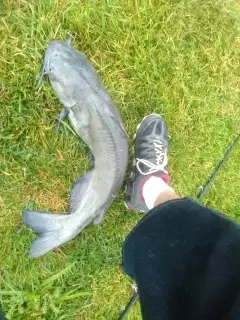
uploaded by: Mike Brooks (Savage)

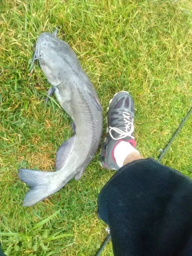
uploaded by: Terry Foster
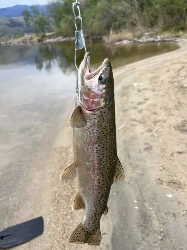
uploaded by: Doug Parr
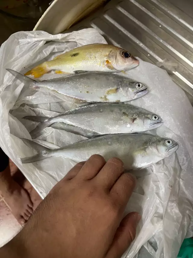
uploaded by: Ahmed Elbasha
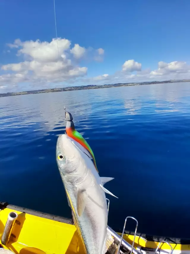
uploaded by: Hoza
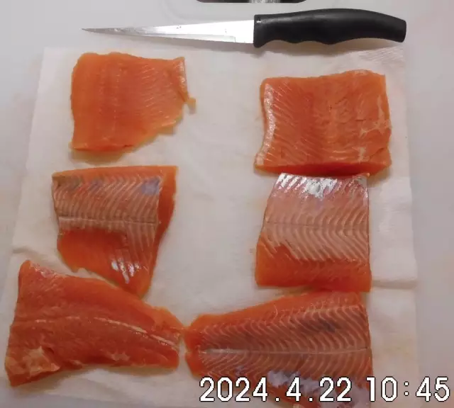
uploaded by: PT Edward fisher
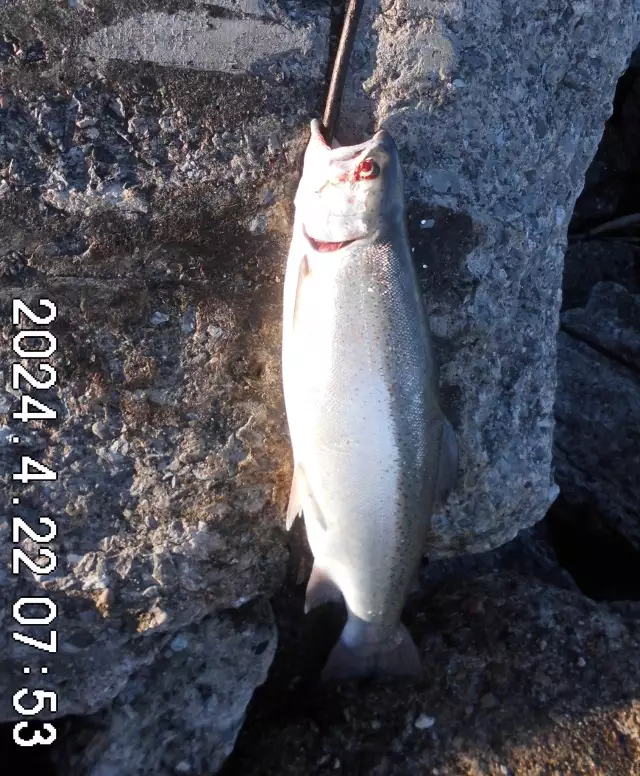
uploaded by: PT Edward fisher
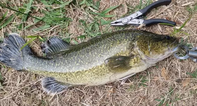
uploaded by: This_Big110
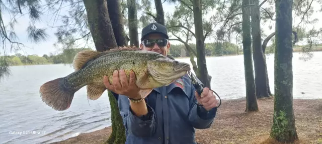
uploaded by: This_Big110
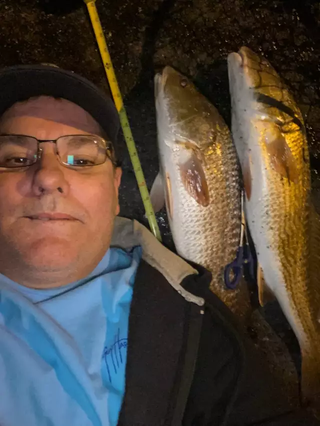
uploaded by: dleedga
Best Fishing Spots in the greater Leisure World area
We found a total of 98 potential fishing spots nearby Leisure World. Below you can find them organized on a map. Points, Headlands, Reefs, Islands, Channels, etc can all be productive fishing spots. As these are user submitted spots, there might be some errors in the exact location. You also need to cross check local fishing regulations. Some of the spots might be in or around marine reserves or other locations that cannot be fished. If you click on a location marker it will bring up some details and a quick link to google search, satellite maps and fishing times. Tip: Click/Tap on a new area to load more fishing spots.
Upper Rock Creek Watershed Site Number 1 Dam - 4km , Upper Rock Creek Watershed Site Number 5 Dam - 5km , Wheaton Regional Park Dam - 5km , Browns Bridge - 10km , Brighton Dam - 11km , Snells Bridge - 11km , Boundary Bridge - 13km , Lake Walker-Pond Number Two Dam - 13km , Riley Spring Bridge - 14km , Contee Main Settling Pond Dam - 14km , Elysium Lake - 14km , Lake Placid Dam - 14km , Lake Walker Dam - 14km , Lake Whetstone Dam - 14km , Three Sisters Lakes - 14km , Rolling Meadow Bridge - 15km , Lake Helene - 15km , Inspiration Lake Dam - 15km , Lake Lynette - 15km , Nirvana Dam - 15km , Lake Nirvana - 15km , North Creek Dam - 15km , Cabin John Bridge - 16km , Cabin John Island - 16km , Cedar Island - 16km , Foreman Branch Dam - 16km , Lock 7 - 16km , Boulder Bridge and Ross Drive Bridge - 17km , Bealls Island - 17km , Chatauqua Island - 17km , Dots Island - 17km , Gladys Island - 17km , Great Falls Estate Dam - 17km , Langley Island - 17km , Lock 10 - 17km , Lock 11 - 17km , Lock 12 - 17km , Lock 13 - 17km , Lock 14 - 17km , Lock 8 - 17km , Lock 9 - 17km , Lock Island - 17km , Minnie Island - 17km , Minnehaha Island - 17km , Plummers Island - 17km , Rock Run Culvert - 17km , Ruppert Island - 17km , Swains Lock - 17km , Swainson Island - 17km , Sycamore Island - 17km , Wades Island - 17km , Cantilever Bridge - 18km , Fron Bridge - 18km , Iron Bridge - 18km , Pebble Dash Bridge - 18km , Sixteenth Steet Bridge - 18km , Tiger Bridge - 18km , American Legion Memorial Bridge - 18km , High Island - 18km , Little Falls Dam - 18km , Lock 6 - 18km , Powhatan Island - 18km , Snake Island - 18km , Black Pond - 18km , Turkey Island - 19km , Bluff Bridge - 19km , Klingle Ford Bridge - 19km , Saint Albans Bridge - 19km , Washington Aqueduct - 19km , Conn Island - 19km , Greenbelt Dam - 19km , Hermit Island - 19km , Herzog Island - 19km , Johns Hopkins University Dam - 19km , Lock 16 - 19km , Lock 17 - 19km , Lock 18 - 19km , Lock 19 - 19km , Lock 5 - 19km , Offutt Island - 19km , Olmsted Island - 19km , Perry Island - 19km , Vaso Island - 19km , Little Sluice Island - 19km , Big Sluice Island - 19km , Chain Bridge - 20km , Charles Richard Drew Bridge - 20km , Duke Ellington Memorial Bridge - 20km , Harvard Street Bridge - 20km , Shoreham Hill Bridge - 20km , Thompsons Bridge (historical) - 20km , William Howard Taft Bridge - 20km , Woodley Bridge (historical) - 20km , Bear Island - 20km , Lock 15 - 20km , Riggs Farm Pond Dam - 20km , Rocky Islands - 20km , Sherwin Island - 20km
Comments